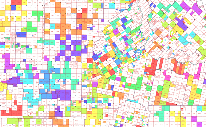
Mantenha conjuntos de dados corporativos e aproveite a inteligência comercial e as análises geológicas com soluções inovadoras e dados geoespaciais precisos. Obtenha uma visão clara do seu cenário competitivo, entenda as oportunidades futuras e tome decisões bem informadas com rapidez e confiança.

Informações de qualidade em que você pode confiar
Ter acesso a informações confiáveis de rede, arrendamento, propriedade e poços para as principais áreas de produção de petróleo e gás nos Estados Unidos permite que os usuários vejam onde seus concorrentes estão operando, bem como onde os ativos deles estão hoje e onde pode haver oportunidades de expansão futura.
Um ponto de vista único
Obtenha uma vantagem competitiva integrando poços, arrendamentos e unidades de agrupamento para identificar áreas potenciais de superfície aberta ou oportunidades de joint venture. Aproveite o uso multifuncional: terra, desenvolvimento de negócios, analistas de GIS e geotecnologias para que todos tenham as ferramentas necessárias para tomar decisões importantes com clareza.


THAT é o nosso foco
Informações precisas mudam tudo. Com uma reputação baseada na precisão espacial, nosso foco na Qualidade da Informação fornece aos clientes dados completos (Thorough), harmoniosos (Harmonious), precisos (Accurate) e oportunos (Timely) - THAT - nos quais eles podem confiar para ajudá-los a executar fluxos de trabalho e cumprir objetivos com confiança.
Roteiro orientado ao cliente
Ao adotar tecnologias inovadoras, melhorar continuamente a qualidade das informações, expandir as áreas de cobertura, melhorar as metodologias de entrega e adicionar novas camadas e soluções, ouvimos e respondemos ativamente às necessidades dos clientes em um cenário de negócios em constante mudança.


Opções escaláveis para atender às necessidades de negócios em constante mudança
Ajudamos empresas de todos os tamanhos a ter uma visão clara do cenário competitivo. Aproveite as opções de licenciamento e cobertura personalizáveis com áreas de interesse escaláveis, desde cobertura nacional ou regional até municípios individuais e áreas de interesse focadas.
Soluções para toda a empresa
Soluções de dados que todas as equipes podem acessar, incluindo conteúdo de dados, análise e metodologias de integração de dados. Acesso 24 horas por dia, 7 dias por semana às nossas informações mais atualizadas por meio do Portal de Dados do IFS Tobin ou da REST API.

Produtos IFS Tobin
-
Rede
O IFS Tobin Grid é a base da família de produtos IFS Tobin, fornecendo a cobertura de rede/pesquisa mais abrangente e contínua do setor. Os dados de rede não são estáticos e exigem manutenção constante. Os analistas de GIS pesquisam/atualizam ativamente a rede, fornecendo um mapa de base em que os clientes podem confiar para suas necessidades de mapeamento.
-
Poços
Os poços IFS Tobin fornecem localização de superfície e fundo de poço e informações de cabeçalho para o ciclo de vida completo do poço. Antes da liberação, os poços devem passar pelas regras de negócios estabelecidas e ser avaliados por analistas de GIS experientes, garantindo localização e atribuição precisas. Veja onde seus concorrentes estão operando ou onde pode haver oportunidades de aquisição.
-
Arrendamento
O IFS Tobin Leases ajuda os clientes a ver onde os concorrentes estão fazendo arrendamentos e onde pode haver novas oportunidades de arrendamento. Coletados no nível municipal, os arrendamentos são mapeados por analistas de GIS para garantir que estejam espacialmente corretos. Pseudônimos foram adicionados à nossa atribuição para ajudar em pesquisas e análises. Arrendamentos federais ajudam a completar o cenário dos arrendamentos no oeste dos Estados Unidos.
-
Propriedade
O IFS Tobin Ownership fornece uma visão instantânea para ajudar a identificar os proprietários superficiais de parcelas de terra. Também pode servir como ferramenta para ajudar a mapear ativos proprietários.
-
Unidades de Agrupamento
O IFS Tobin Pooling Units permite que os usuários rastreiem a atividade de unidade para unidades/áreas de agrupamento coletadas no nível municipal. São uma ferramenta para ajudar no planejamento ou para ver onde os concorrentes estão operando.
-
Mapas Impressos
Alternativa aos dados digitais, nossos mapas impressos podem ser entregues como PDFs ou impressões em papel para que você possa levar o IFS Tobin para qualquer lugar.
-
Mapeamento Personalizado
Nada supera a capacidade de personalizar seu próprio mapa. Adoramos trabalhar com os clientes para criar o mapa perfeito para atender às necessidades de seus projetos.

Suporte ao cliente
Com anos de experiência em IFS Tobin e conhecimento do setor, nossa equipe dedicada está disponível para ajudar a responder perguntas técnicas ou sobre produtos e fornecer treinamento e documentação.
Soluções para o seu setor
Soluções para Terrenos
Software upstream de terrenos de petróleo e gás que gerencia todo o fluxo de trabalho, desde o gerenciamento de títulos até a aquisição de arrendamento, até a administração e desinvestimento de terrenos.
Soluções de Contabilidade
Software de contabilidade de petróleo e gás upstream desenvolvido para simplificar a contabilidade complexa e fornecer uma visão de 360° do desempenho financeiro da empresa. Lida com as necessidades exclusivas de alocação de receita e contabilidade de joint venture.
Soluções de Produção
Software de produção integrado que otimiza o desempenho de ativos para mais de 50% dos poços nos EUA e milhares de outros em todo o mundo. Permite alocações precisas de volume, captura e validação eficazes de dados de campo, visualização de dados em tempo real e muito mais.
Poder do IFS Energy
Gestão de todo o seu negócio de petróleo e gás upstream através da solução de ponta a ponta líder de mercado da IFS que abrange toda a cadeia de valor upstream, desde operações de campo e aquisição de terras até contabilidade financeira.


